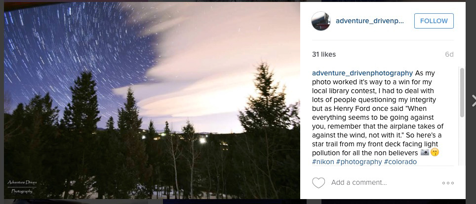
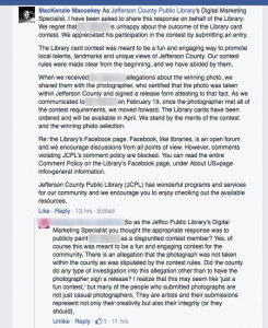
The following is a visual timeline of events as illustrated by information posted publicly to various websites, some of which may have since been hidden, deleted or locked by the photographer and/or Jefferson County Public Library in order to restrict public visibility.
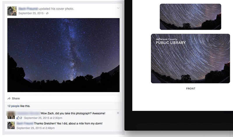
Image nearly identical to ‘star trails’ image resides on photographer’s Facebook page (showing similar trees and same ridgeline). Note that back on 9/25/15 he says he captured it a ‘mile from (his) dorm’.
Early conversation initiated immediately after finalists were announced that has now been mostly deleted and/or hidden from JeffCo Public Library’s photo page (by both the photographer and the Library) where voting was occurring. Curiously, instead of leaving the conversation public so that people can decide for themselves early in the voting, the Library hides the inquisitive citizen from public view:
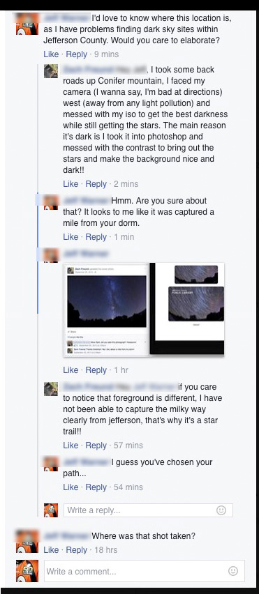
When directly addressed about the similarities of the image, the photographer incorrectly asserts that the location of the similar image was ‘towards Aspen’.

The photographer’s image of the Milky Way over Mt. Sopris, said to have been taken ‘towards Aspen’:
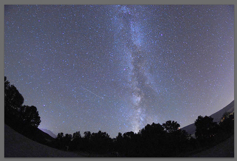
The mountain can be confirmed to be Mt. Sopris using a variety of methods. If the image had been captured from Aspen, the view of Mt. Sopris would be taken facing west, not south, and the southern Milky Way would not lie to the right of Mt. Sopris, it would lie to the left of it.
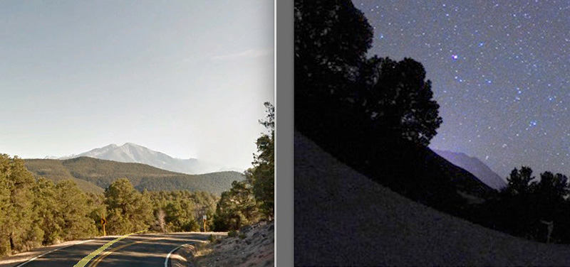
Via aerial photographs, a Jefferson County citizen is able to identify the precise location from which the ‘Mt. Sopris Milky Way’ image was captured, and directly refute the photographer’s claim as to the location of it having been taken ‘towards Aspen’. The exact trees in his image can be seen by anyone on Google Earth Street view, and confirms that the image was captured 7 miles SSE of Glenwood Springs, CO. Voting is still underway.
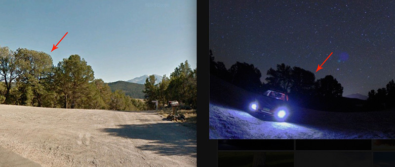
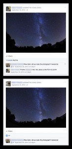
Self-incriminating comment proves that the nearly-identical ‘Mt. Sopris’ image was captured by the photographer within a mile of the CMC Spring Valley campus, 7 miles SSE of Glenwood Springs; comment has since been deleted (date unknown). Comment was made by the photographer back in September, prior to having a reason to lie about it. Before and after screenshots:
A concerned Jefferson County citizen questions the source of the ‘star trails’ image, only to be dismissed, and then the comment is hidden from public view:
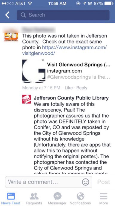
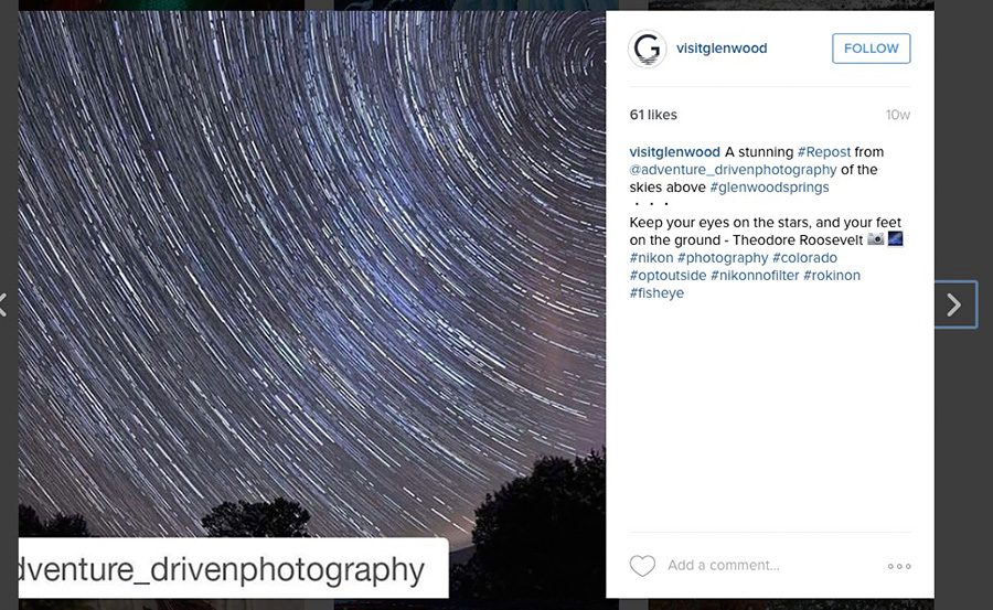
The VisitGlenwood Instagram site, featuring the ‘star trails’ image (the image has since been removed from the VisitGlenwood site at the request of the photographer):
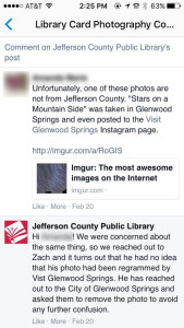
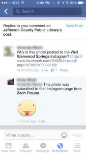
An additional JeffCo citizens raised a red flag with the ‘star trails’ image on the Visit Glenwood Instagram site:
One of the comments to the original posting regarding the image being intentionally posted to the VisitGlenwood Instagram page by the photographer (note that the comment was hidden by Jefferson County):
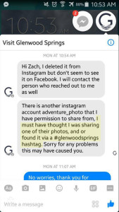
The photographer in question receives a response from VisitGlenwood regarding VisitGlenwood’s presentation of the ‘star trails’ image (note they admit that they may have gotten it automatically by its original #glenwoodsprings hashtag):
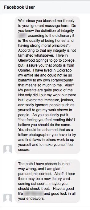
An anonymous message received by a citizen of Jefferson County sent by the photographer:
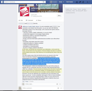
A Jefferson County Public Library response to a citizen who noted the VisitGlenwood problem; note that the citizen is suggested to be defamatory to the photographer in question, and the Library expresses ‘shock and dismay at the level of animosity displayed by the community’:
In the meantime the photographer smugly posts an image to his Instagram account thought to back up his position that ‘a star trail image can be captured in Jefferson County’. Unfortunately it also proves that said image cannot be captured without abundant light pollution, and that images from Conifer exhibit additional traits characteristic of images from the FrontRange, that is, lights from homes, ‘pointy’ pine trees, and non-straight ridgelines and hills. Comments to that effect are quickly deleted by the photographer, and citizen is locked out from viewing or commenting on the Instagram account.
Weeks prior to traveling to Glenwood Springs, CO, a JeffCo citizen was able to narrow down the location of the ‘star trails’ image to a very small vicinity located 7 miles south of Glenwood Springs, CO near Springs Valley Road, and transmit directions to a member of the public in Glenwood Springs who was then able to drive directly to the vicinity where the ‘star trails’ image was captured, then walk 250 meters down a dirt road to directly observe the exact trees, ridgeline, road and house shown in the offending image.
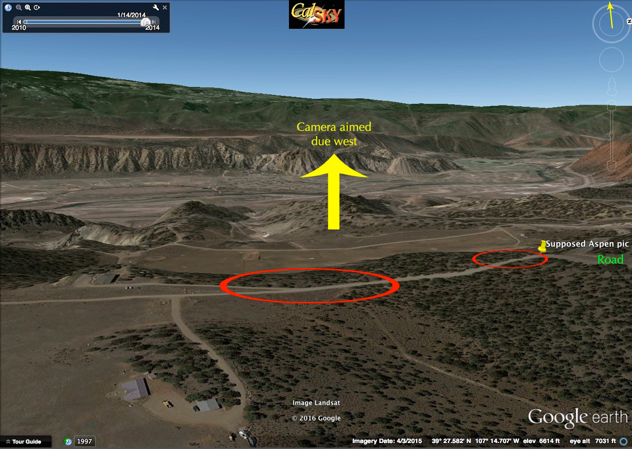
And lastly, on 3/4/16 the precise location from which the ‘star trails’ image was captured was confirmed, including a daytime image (warped to match ‘fisheye’ view of photographer’s lens) showing the exact same treeline and flat ridgeline, specific location capture data, coordinates of the location converted and plotted on map, and a Google Earth view of the actual location. The location is confirmed to lie 7 miles SSE of Glenwood Springs in Garfield County, less than one mile from the Spring Valley CMC campus, as originally asserted by several citizens of Jefferson County:

In no uncertain terms, the photographer lied about the location of the ‘star trails’ image in order to win the contest, and for some inane reason Jefferson County Public Library chose to ignore (from the beginning) all evidence presented to them, deleted the comments of citizens concerned about the authenticity of the image, and continues to refuse to comment on the confirmed source of the image.
On 3/9/16 Jefferson County Public Library finally publicly responds to the facts being posted, and instead of providing actual evidence to the contrary, chooses to refute the claims by attempting to discredit one or more JeffCo citizens by painting them as ‘disgruntled contest losers’ (note one JeffCo citizen’s response to their approach):


